A regional block,
70 gigapixels
At the other end from a pocket camera: a large-format digital aerial camera, frames of 196 megapixels, three strips flown across a whole plain down to the sea. The same StereoCAD that measures an excavation from a few dozen snapshots takes the block as one project, shows it end to end, and puts any pair of it in stereo at the native pixel.
- 357frames of 196 megapixels
- 267 GBof images, one project
- 109 kmby 9, about 900 km²
- 20 cmon the ground per pixel
The block
Each frame is 17,310 × 11,310 pixels from a 100 mm lens, flown at about 3,300 metres: 20 cm on the ground, 3.4 by 2.3 km per frame. Three strips of about 120 frames each, 108 km long, with the exterior orientation of a regional aerial triangulation and the camera calibration from the manufacturer.
357 frames, 70 gigapixels, 267 GB of uncompressed images: more than a hundred times the pixels of the excavation flown with a pocket camera, in the same program.
Imported from two files
The triangulation file and the camera file are all StereoCAD needs: the images stay where they are and are never copied. The file did not say how the camera was mounted; StereoCAD finds the 90-degree rotation on the pictures themselves, and checks pairs of images before accepting the block: their rays meet within 0.4 to 0.5 pixels in the median.
Preparing the 357 frames for stereo, which means reading 267 GB once, takes 38 minutes. After that, any pair opens at once.
The whole block, end to end
A first pass over all 357 frames at reduced resolution, on the graphics card, in seven minutes: 100 million points and an orthophoto of 34,210 × 2,720 pixels covering the corridor, 109 by 9 km, with no visible seams between frames or strips. Enough to see the whole job at once, find a place and plan the work.
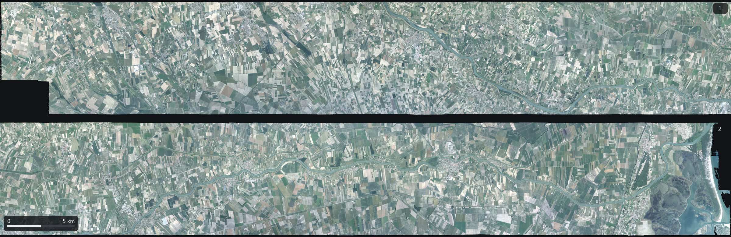
The corridor in two halves, west (1) and east (2). Orthophoto at 3.2 m, computed by StereoCAD from the 357 frames.
From 100 kilometres to a road marking
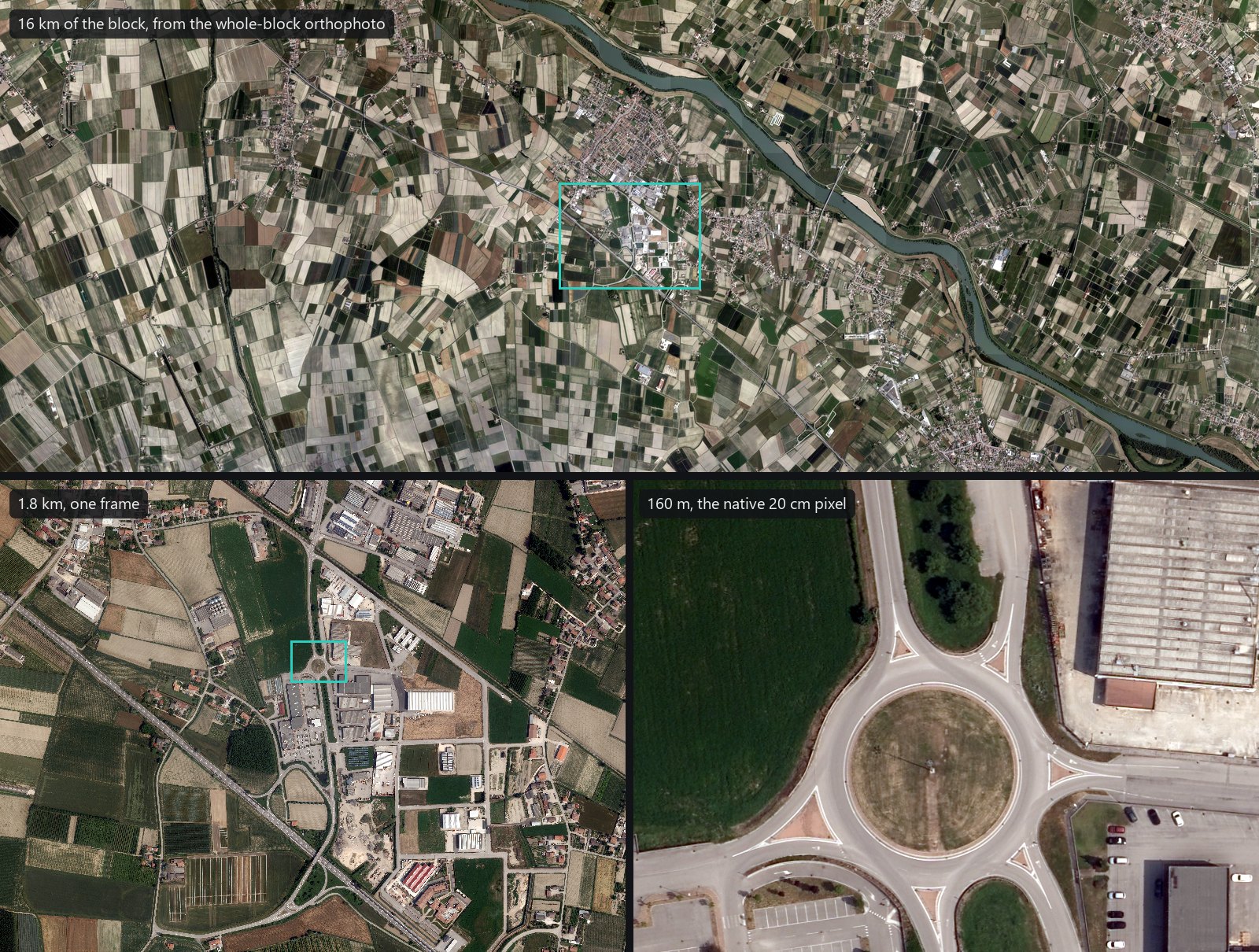
The same block at three scales: a piece of the corridor, one frame, and a roundabout at the camera's native pixel, where road markings, cars and the panels of a roof can be counted.
In stereo, for the map
This is what a block like this is flown for: drawing the map in stereo. Two consecutive frames, 904 m apart, resampled onto a horizontal plane at the native 20 cm; roofs and walls shift sideways against the streets, and the eyes read that shift as height. Here the two are alternated.
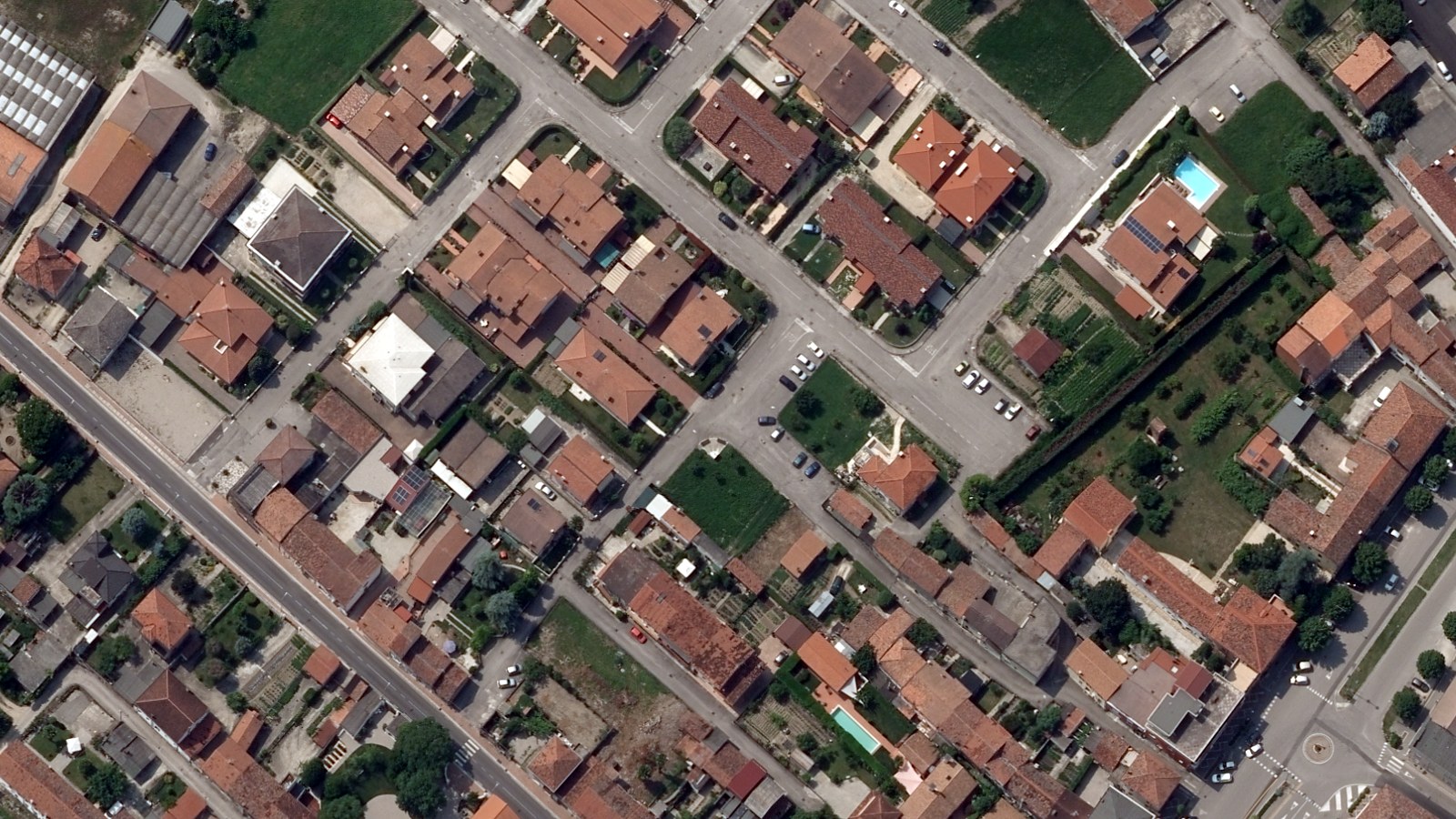
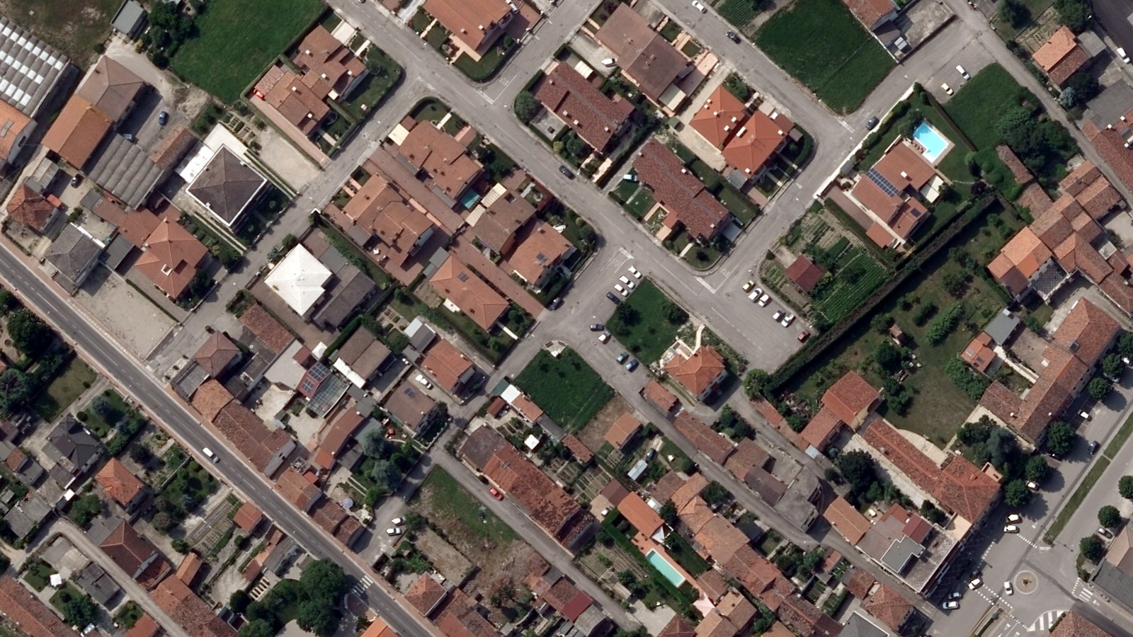
No vertical parallax between the two eyes: 0 pixels in the median over 65 patches of the pair.
One program, any camera
A 7-megapixel pocket camera over an excavation, a compact under a small drone over a golf course, a large-format camera over a whole plain: StereoCAD takes them all the same way, from the orientation to the stereo model and the drawing. What changes is only the size of the job.