An excavation,
from a pocket camera
We flew a small quadcopter over an archaeological excavation, with an ordinary pocket camera looking down. No surveyor, no GPS, no points measured on the ground: half an hour on site. StereoCAD orients those pictures today and turns them into a stereo model, a surface and an orthophoto finer than one centimetre: the kind of record an excavation with no budget for a survey can still afford.
- 81photographs, under half an hour
- 0.85 cmon the ground per pixel
- 0.28 pxresiduals, camera calibrated in the block
- 92 millionpoints, one every 8 mm
The kit
A pocket camera with a 1/1.7-inch sensor, set to 3072 × 2304 pixels, the zoom at its widest, 7.9 mm. The same exposure in every picture, 1/500 s at f/8 and ISO 100. It hangs under a small quadcopter flown at about 28 metres, in seven passes across the site.
The archaeologists had already marked their finds with small white cards; nobody put out targets for the flight, and nobody measured anything for it.
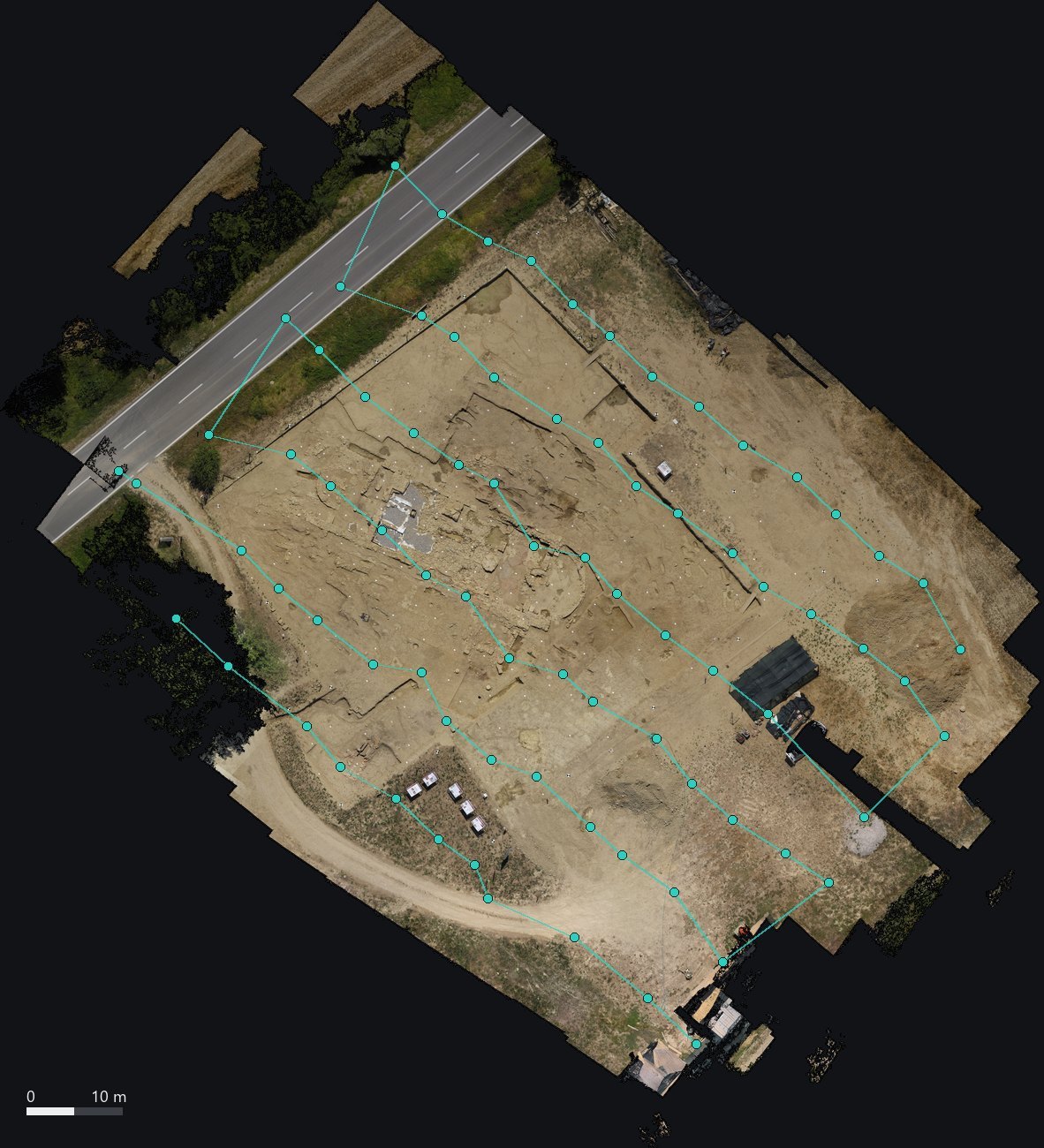
The camera positions over the orthophoto computed from the same pictures. Gaps in the orthophoto are where a picture was missing or the ground was hidden, as under a parked car.
Oriented with nothing to hold on to
StereoCAD finds the tie points itself and calibrates the camera in the same adjustment: focal length, principal point and the distortion of a cheap zoom lens. 80 of the 81 pictures are oriented in two and a half minutes, with 103,000 tie points; the residuals in the images are 0.28 pixels RMS. The one left out shows only the top of a tree.
Without ground points the block has no coordinates and no scale of its own, and StereoCAD says so in its report. The scale comes from the site itself: the dashes of the road markings next to the excavation have a standard length, 3 metres every 7.5. A car parked on site, measured in the model, agrees within five per cent.
In stereo
Two pictures of the same pass, resampled onto a horizontal plane, one per eye. The walls of the apse and the round structure inside it stand out against the floor; here the two pictures are alternated.
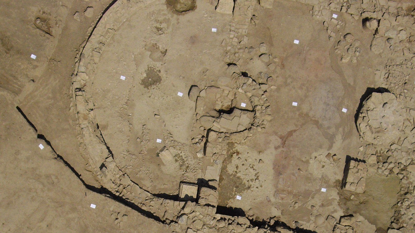
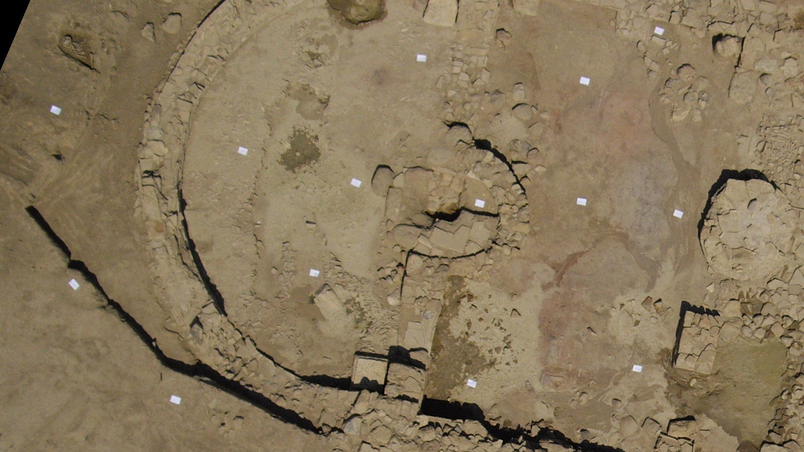
No vertical parallax between the two eyes: 0 pixels in the median over 114 patches of the pair.
The surface, stone by stone
At full resolution StereoCAD compares 705 pairs and merges them into 92 million coloured points, one every 8 mm, in about three minutes on the graphics card. From the cloud come a DSM with a 1.7 cm cell and an orthophoto at 8.4 mm.
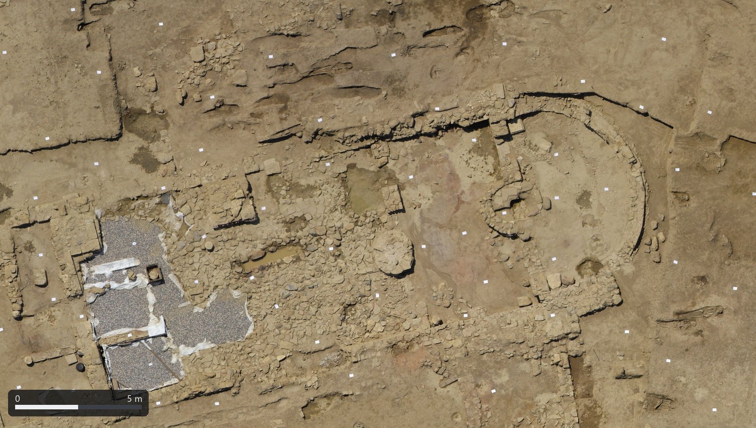
The same area as a surface: the floor of the building, the foundations, the round structure in the apse and the pits, each at its own depth.
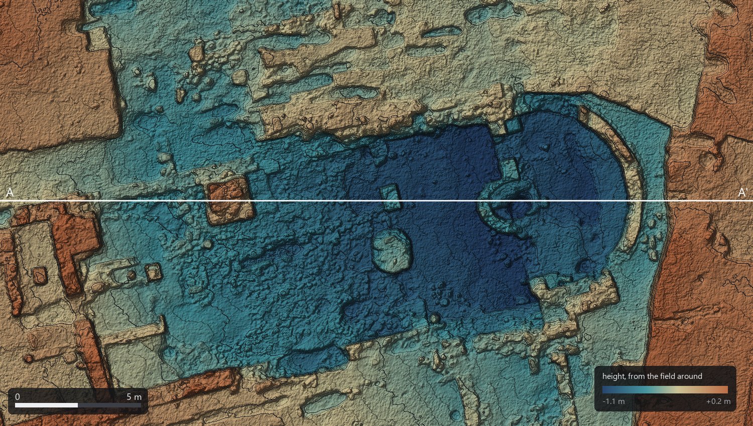
Shaded DSM, relief exaggerated twice, contours every 5 cm. Heights are relative to the field around the building: the block has no ground points, so there is no absolute height.
A section, without a level
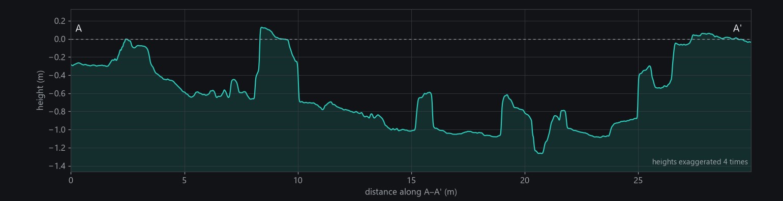
A section along the axis of the building, read from the DSM: the floor about a metre below the field, walls and bases standing up to 70 cm above it, the round structure in the apse. On an excavation this is usually drawn by hand, with a level and a tape; here it comes from the same half hour of flight.
Cheap kit, one rule
A pocket camera and a small drone are within reach of any excavation, and StereoCAD gets everything out of their pictures: the orientation, the camera calibration, the stereo model to draw the walls in, the surface and the orthophoto. What the pictures cannot give is the position on the ground. Measure four or five points around the trench, even with a total station borrowed for an hour, and the same flight becomes a survey in your coordinates, with the accuracy checked.