Zeche Zollern,
from raw drone images
A folder of photographs from a small fixed-wing drone over a historic colliery in Dortmund: no orientation, no control points, only the drone's own GPS in the pictures. StereoCAD orients the block itself, checks every image, and computes the dense cloud, the DSM and a 2 cm orthophoto of the historic buildings. The data are a public benchmark: anyone can repeat every step.
- 583raw drone images
- 577oriented in 15 minutes
- 0.47 pxRMS of the image residuals
- 218 millionpoints, one every 2 cm
A public benchmark
Zeche Zollern is a colliery of the early twentieth century, today a museum of industrial heritage. In 2014 it was surveyed for the ISPRS/EuroSDR Benchmark for Multi-Platform Photogrammetry: drone images from above and at an angle, ground photographs and a terrestrial laser scan of the facades. This story uses the nadir flight of a Mavinci Sirius drone with a Panasonic GX1 camera: 583 images, each with the drone's navigation GPS in its EXIF header.
Data: ISPRS/EuroSDR Benchmark for Multi-Platform Photogrammetry (Nex et al., 2015), provided by ISPRS and EuroSDR.
A folder of photographs
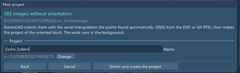
New project, choose the folder. StereoCAD sees 583 images without any orientation and offers to orient them: tie points found automatically, positions taken from the GPS in the images. The work runs in the background.
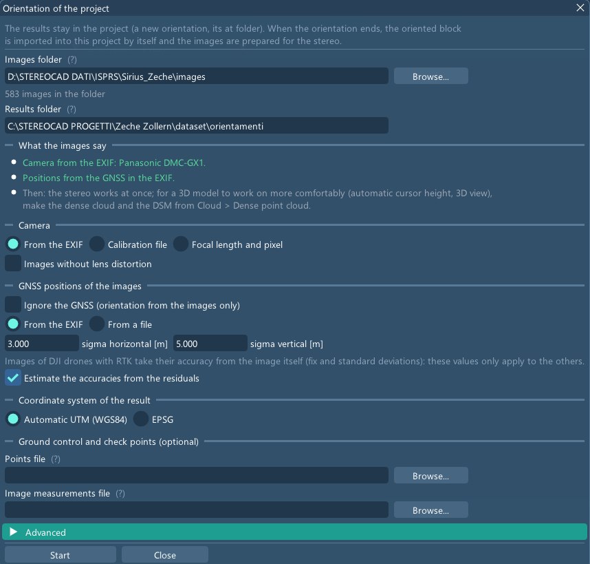
What the images say
Before starting, the window lists what it read from the images: the camera model and the GPS positions. The camera is calibrated during the adjustment; ground control points can be added from a file, and here there are none.
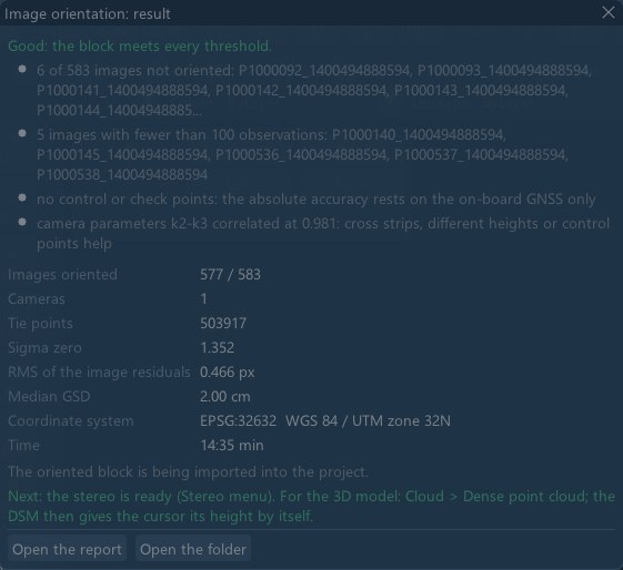
Oriented in fifteen minutes
5.8 million feature points, 6,629 neighbouring pairs compared, half a million tie points, then the bundle adjustment. 577 of the 583 images are oriented; the residuals in the images are 0.47 pixels RMS. The six images left out, which share too few points with their neighbours, are listed by name.
The result says what it can and cannot guarantee: without control points, the absolute position of the block rests on the drone's GPS alone.
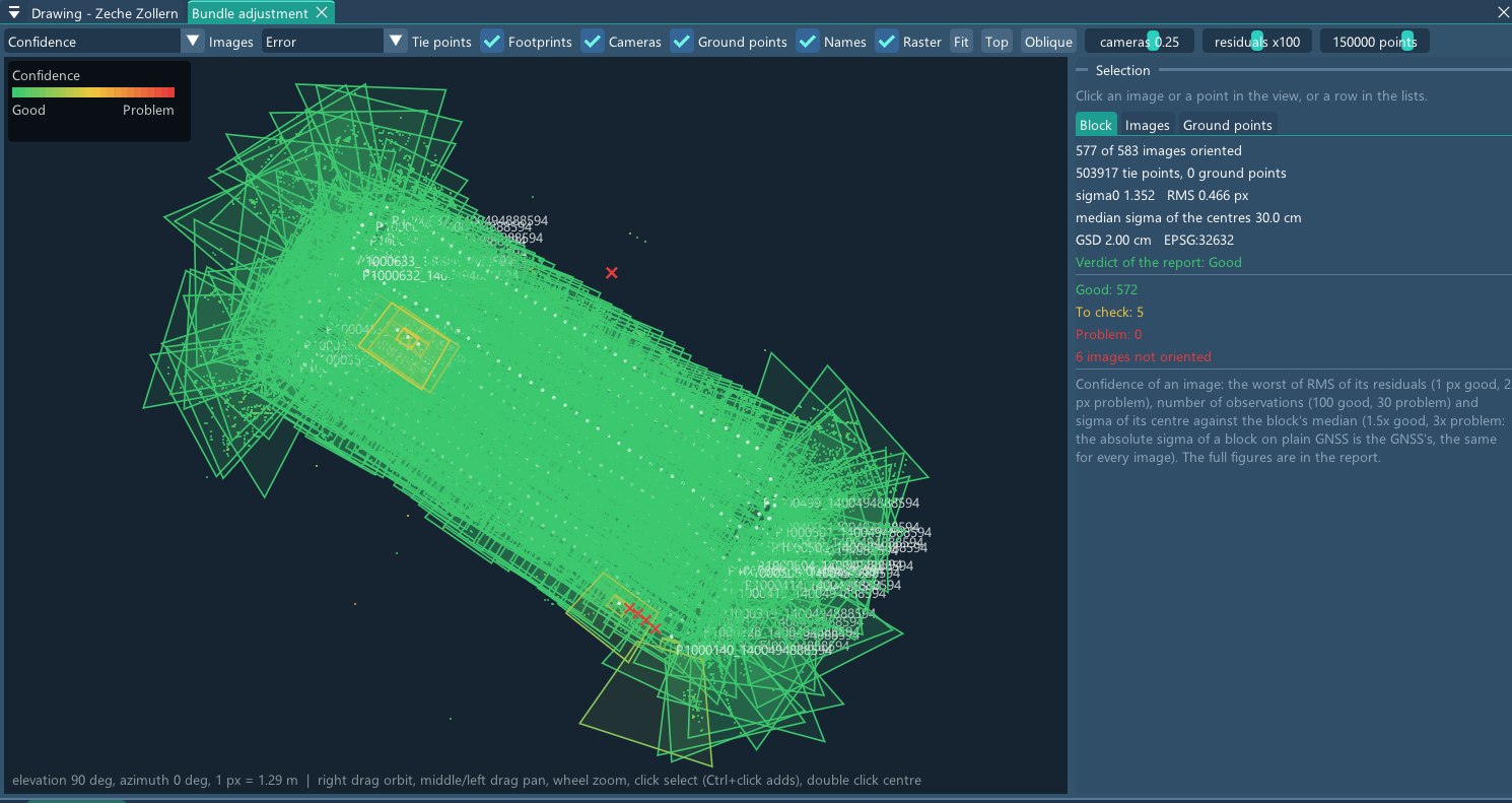
Every image, judged
The adjustment view shows the cameras over the block, coloured by confidence: 572 good, 5 to check, none with a problem. Clicking an image or a point shows its residuals; the full figures are in the report.
The surface, where it matters
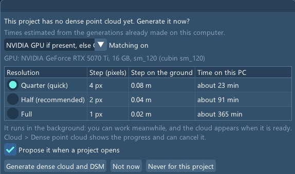
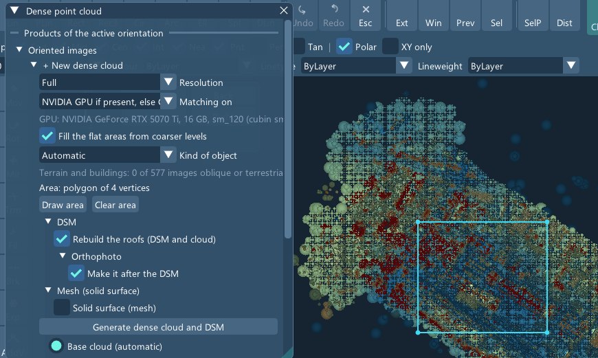
For the whole block, StereoCAD estimates the time on this computer: from 23 minutes at a quarter of the resolution to six hours at full resolution. Here only the historic buildings were needed, so an area of about six hectares was drawn and computed at full resolution.
The 299 images touching the area, 2,691 pairs and 14,202 megapixels in all, were matched on the graphics card and merged into 218 million coloured points in under eighteen minutes.
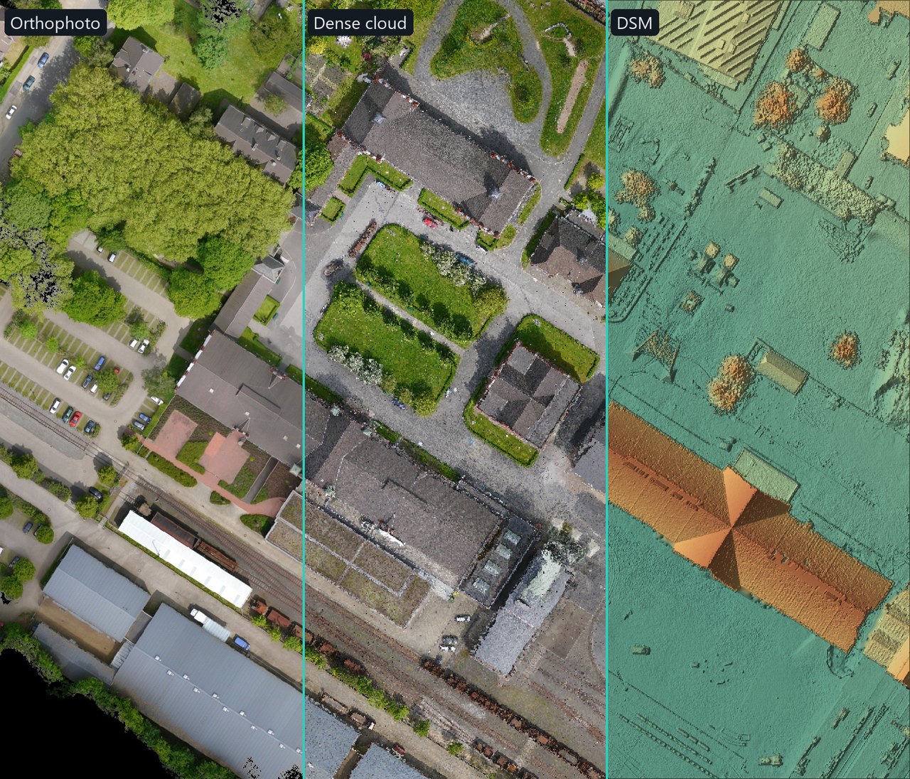
Orthophoto, cloud and DSM
From the cloud come a DSM with a 4 cm cell and an orthophoto at 2 cm. Below, the same area as the three products, drawn from the files StereoCAD wrote.
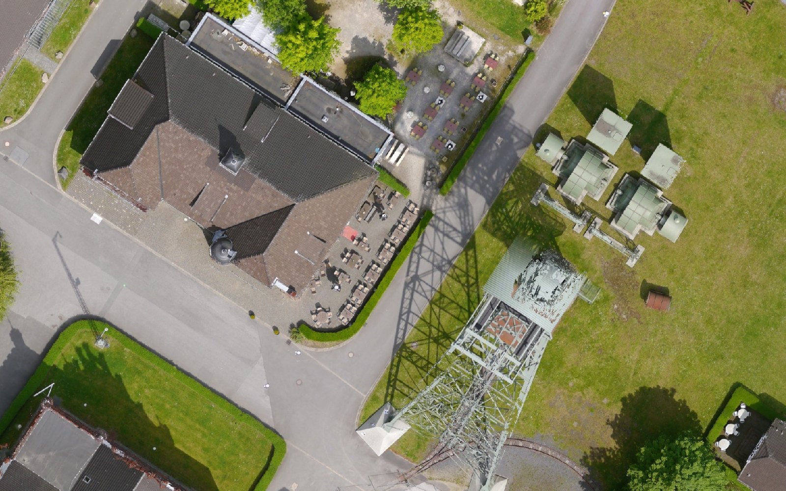
At full resolution, the orthophoto reads paving stones, café tables and the lattice of the headframe. The lattice of the headframe is too thin to enter the DSM, so the orthophoto lays it on the ground at an angle, as every orthophoto does with what the surface does not contain.
All pictures on this page: data of the ISPRS/EuroSDR Benchmark for Multi-Platform Photogrammetry, provided by ISPRS and EuroSDR. Nex, F., Gerke, M., Remondino, F., Przybilla, H.-J., Bäumker, M., Zurhorst, A., 2015. ISPRS Benchmark for Multi-Platform Photogrammetry. ISPRS Annals, Vol. II-3/W4, pp. 135–142.