A golf course,
from a compact camera
We flew a small multicopter over a golf course under construction, with a 10-megapixel pocket camera looking down and a few white targets on the grass. No GPS in the pictures, no camera calibration, a flight steered by hand. StereoCAD orients those photographs and measures the hole to two or three centimetres: proof that cheap equipment and a few points on the ground are enough.
- 161photographs, 5 minutes of flight
- 1.6 cmon the ground per pixel
- 7 + 8control and check points
- 2-3 cmon the check points
The kit
A compact camera with a 1/1.7-inch sensor, 3648 × 2736 pixels, the zoom left at its widest, 6 mm. The same exposure in every picture, 1/500 s at f/4 and ISO 80, one picture every 1.7 seconds. The camera hangs under a small multicopter flown by sight at about 40 metres. Nothing in the pictures says where they were taken.
On the ground, the surveyor spread white plates and balls around the hole and measured each one with RTK GNSS: 16 points in half an hour, one to three centimetres each. One of them shows no target in the pictures: fifteen remain.
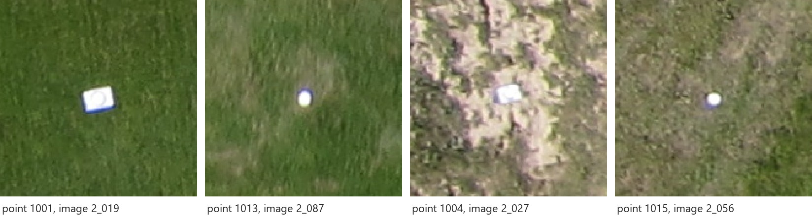
The targets at the camera's native pixel, enlarged 2.5 times: a plate is about 30 cm across, a ball about 15. On bare soil (third picture) the plate is harder to read.
A flight by hand
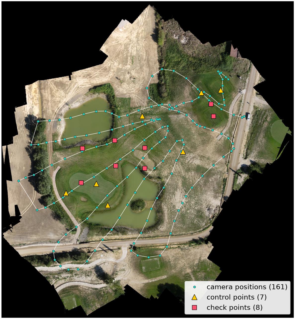
The multicopter flew out and back over the hole, eight passes fanning out from one spot in the middle of the hole: no regular strips, headings changing from one picture to the next, tilts up to twenty degrees. 161 pictures of the eighth hole in four and a half minutes.
Oriented, all of it
StereoCAD finds the tie points itself, starts from the pair of pictures that share the most, and adds the others one at a time. The camera is calibrated in the same adjustment: focal length, principal point and the strong distortion of a compact lens. Seven ground points hold the block in place; the other eight are left out of the adjustment, to measure it.
All 161 pictures are oriented in four minutes, with 215,000 tie points seen on average by 4.6 pictures each. The residuals in the images are 0.53 pixels RMS.
Checked on the ground
The eight check points never entered the adjustment. Their positions, intersected from the oriented pictures, against the RTK survey:
| Points | East | North | Height | |
|---|---|---|---|---|
| Control points (in the adjustment) | 7 | 1.4 cm | 2.0 cm | 3.6 cm |
| Check points (independent) | 8 | 2.0 cm | 3.2 cm | 4.9 cm |
| Check points without point 1009 | 7 | 1.6 cm | 1.3 cm | 2.5 cm |
Root mean square differences. One check point, 1009, is off by 4, 8 and 12 cm: in every picture its target sits a few pixels away from where the survey puts it, so the surveyed position is probably not the centre of the ball. Without it, the check points agree with the survey to about one and a half pixels.
The green, as it is
From the oriented pictures StereoCAD computes the dense cloud, a DSM with a 6 cm cell and an orthophoto at 3 cm. On the green the surface is left as measured: no smoothing, the slopes, the lip of the bunker and the banks of the ponds as the pictures see them.
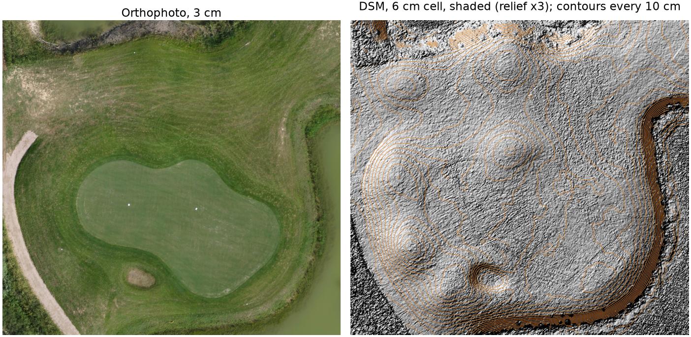
The shading is the DSM as measured, relief exaggerated three times. The contours are drawn on the DSM smoothed over 30 cm and only where the surface is regular (not on water and vegetation).
Against the seven survey points in the area, the DSM is within 2.8 cm RMS; the measurement noise on the putting surface is about 2 cm.
Cheap kit, careful points
The camera and the drone are the cheap part. What makes the survey work is overlapping pictures, a handful of well-measured targets spread around the area, and software that calibrates the camera and tells you, with independent points, how good the result really is.
Data: MENCI Engineering survey of a golf course under construction.